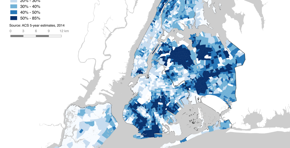
Working with U.S. Census Data View Tutorial This tutorial will guide you through the process of downloading both the geographical boundaries and the census data, bringing them both into QGIS and joining them, and creating a choropleth map.