Tutorial 1: Mapping a Table
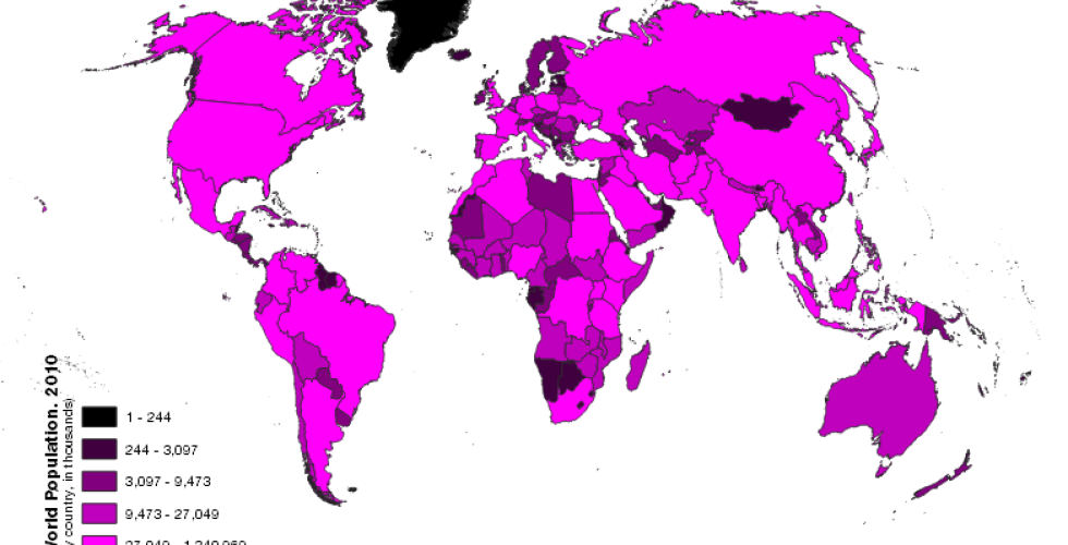
The purpose of this tutorial is to produce and export global map of population by country. For this we will use the national administrative boundaries layer in the previous tutorial, combining it with population data contained in a table. In the process, we will learn more about the QGIS interface, add a csv table to a map project, perform a table join, change the symbology of a vector layer using quantitative attributes, layout and compose a map, and export a finished map.