Mapping Data: World Populations
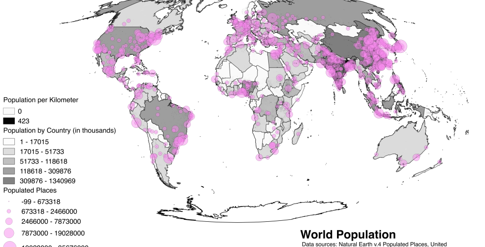
With this exercise, you will learn introductory skills involved in using QGIS to map existing spatial datasets. Using an example of world populations you will have become familiar with the QGIS user interface, learned the components of shapefiles, created a clear and effective map composition, critically considered symbology and classification and the differences, between mapping qualitative and quantitative information, created and calculated new fields in an attribute table, performed a table join to, combine additional data to an existing shapefile’s attribute table, queried a GIS dataset, using both tabular queries and spatial queries.